by Rónán Davison-Kernan
The Laugavegur is a 53 km trail in the Icelandic highlands, an area almost but not quite entirely unlike its Scottish namesake. It connects the ridiculously beautiful geothermal area of Landmannalaugar with the ridiculously beautiful valley of Þorsmörk (pronounced “Thorsmerk”). Most things in Iceland are ridiculously beautiful, except the weather, which given its North Atlantic location is uncannily familiar to anyone who has spent any time in Donegal.
Iceland has a population roughly equivalent to that of Belfast (the actual city, not those hanger-on bits like Carryduff). Most of these live in and around Reykjavík. This leaves a lot of country with not a lot of people, which works for me, as knowing people (being one myself) they tend to spoil things. Icelandic is essentially one massive volcano that has been erupting constantly for the last 20 million years, and the interior is a mix of lava fields and volcanic sand which nothing and no-one can eke out any sort of sustainable existence on. As such it’s a perfect place to go play.
Lisa and I have been to Iceland a few times – it’s the sort of place that gets its talons into you. A good Iceland trip generally involves hiring a car, driving about, and stopping to look at (and smell) the mountains, lakes, geysirs, mud pots, waterfalls and lava fields while hopping between geothermal hot springs. On a trip last year we hired a Dacia Duster 4×4 and drove to Landmannalaugur in the south-central highlands – famed for its beautiful rhyolite mountains and hot spring. It is also, it turned out, the starting point for the Laugavegur (‘way of the hot springs’) trail, a multi-day hut-to-hut walk through some of Iceland’s finest scenery. What caught my attention was that it is also the start point for the Laugavegshlaup Ultra Maraþon (yes, that Icelandic letter again) which covers the same ground in one day, as a race. A perfect ultra; not too ultra, a chance to see the Laugavegur in a day, and enough beauty to distract from the legs. In a ‘sure why not’ moment, I entered the lottery for a place and forgot about it.
Several months later I received a confusing email in Icelandic which on closer inspection revealed that I had gained a place to the Laugavegshlaup. Back, then, to Iceland!
Icelanders are very organised. I suppose you have to be when there’s only a handful of you and you live on a volcano. A steady stream of emails revealed the race plans – buses to the start and finish, baggage transport, a veritable buffet at the aid points, menu choices for the finish, search and rescue teams to guide people across rivers…
The race was on Saturday 16 July but race registration was on Thursday 14th in Reykjavik so I flew out that day and did the messages in the city. Iceland is not the cheapest place in the world, and while it would have been possible to do the race as a 3 day trip staying in Reykjavik each night it would be a shame not to make the most of it. Therefore Lisa arranged to fly out on the day of the race and meet me at the finish, and then we’d stay another week. I raked round Reykjavik on the public hire scooters buying gas and food and on the Friday morning caught the public bus to Landmannalaugur.
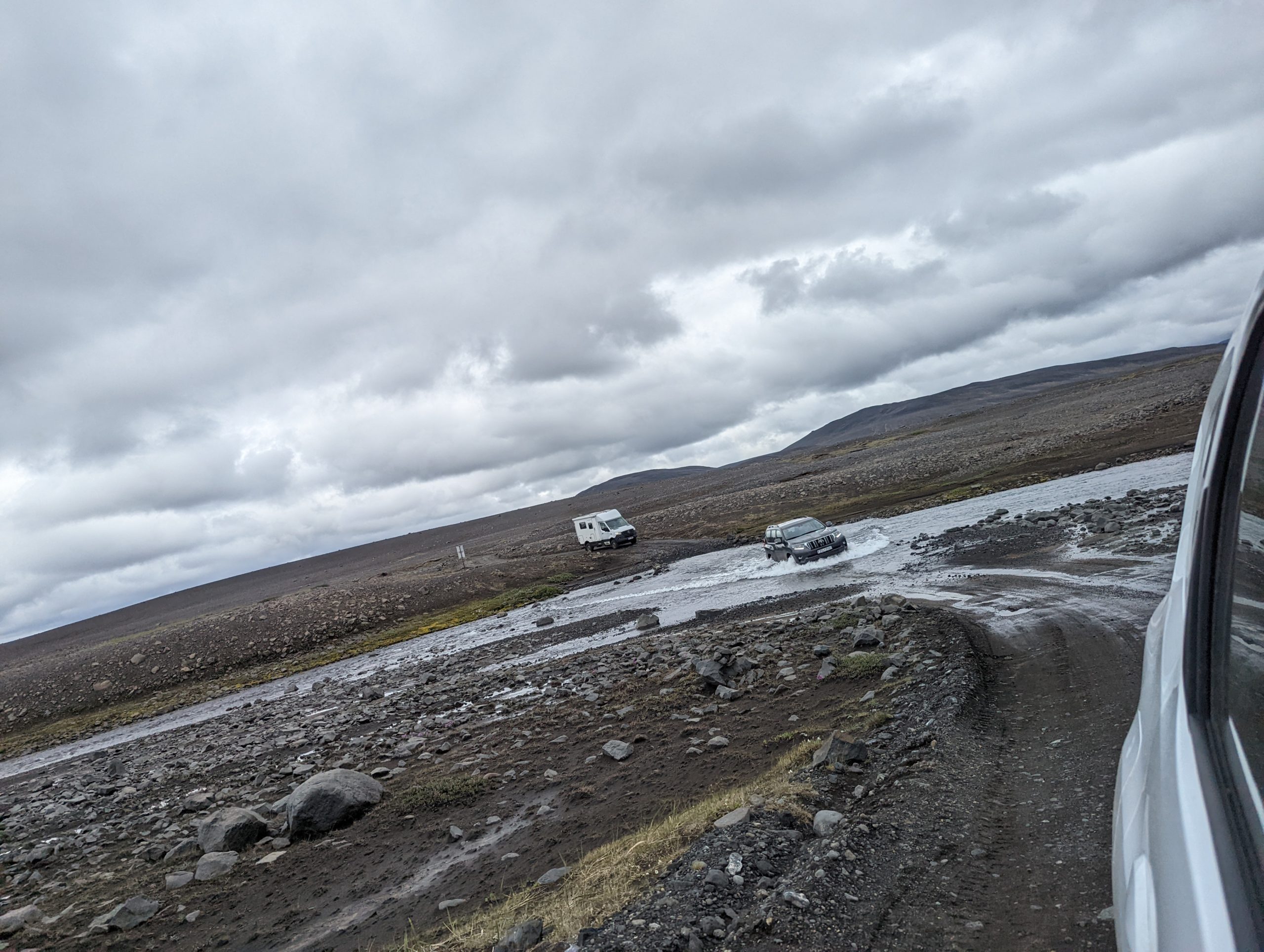
This was (you guessed it) a ridiculously scenic 4 hour journey at first on the famous ring road followed by a succession of gravel tracks passing the volcano Hekla and into the heart of the highlands. Iceland takes conservation very seriously and off road driving and off-path walking are banned, but what counts as a road or path is open to a fair dose of interpretation.
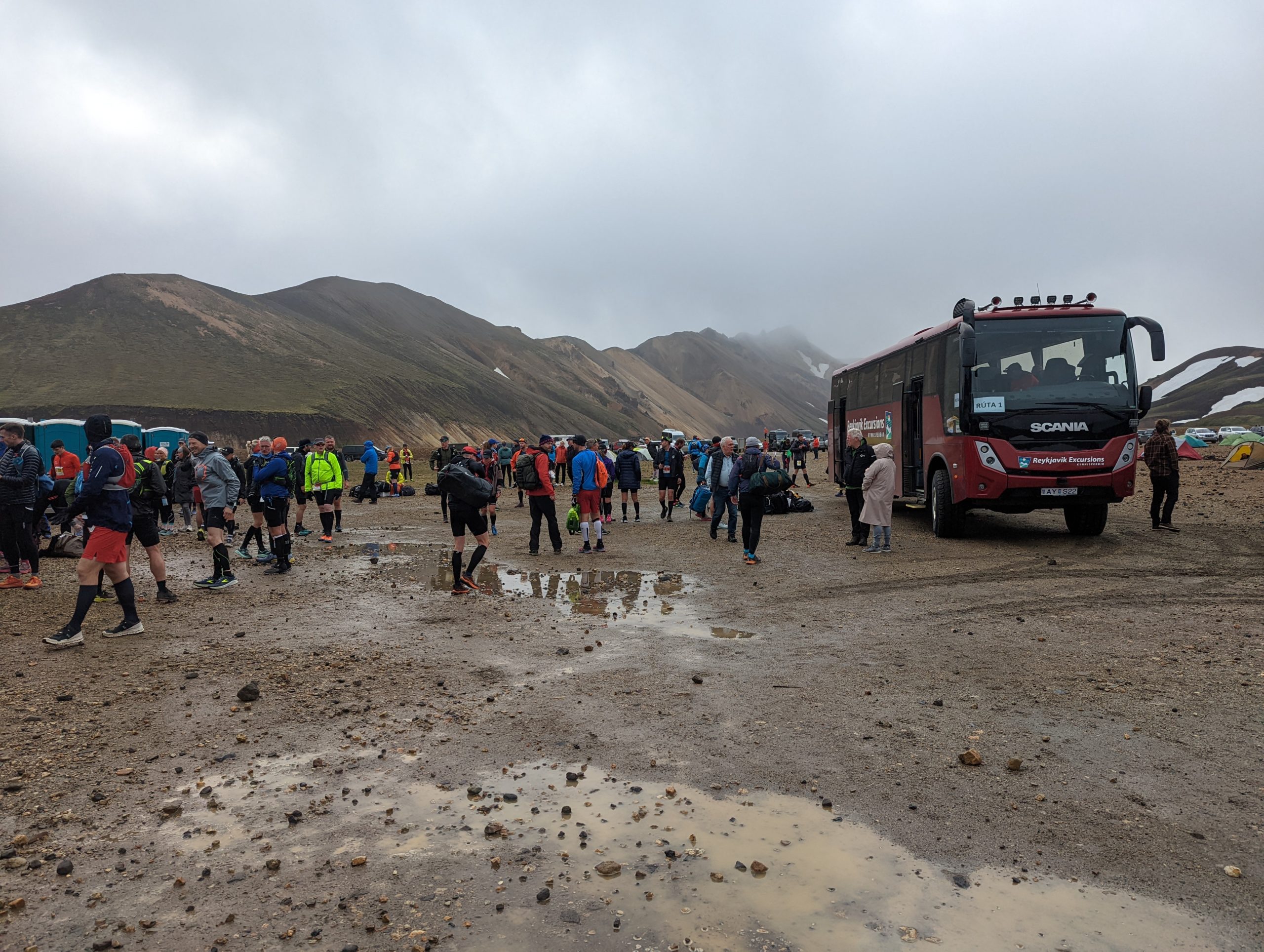
The bus and Landmannalaugur itself were buzzing with people starting the Laugavegur hike – incredulous at the madman planning to run it. “In this weather??” “Aye sure it’s nothing I’m not used to.” 12 degrees and drizzle, sure you can’t be too bad to that.
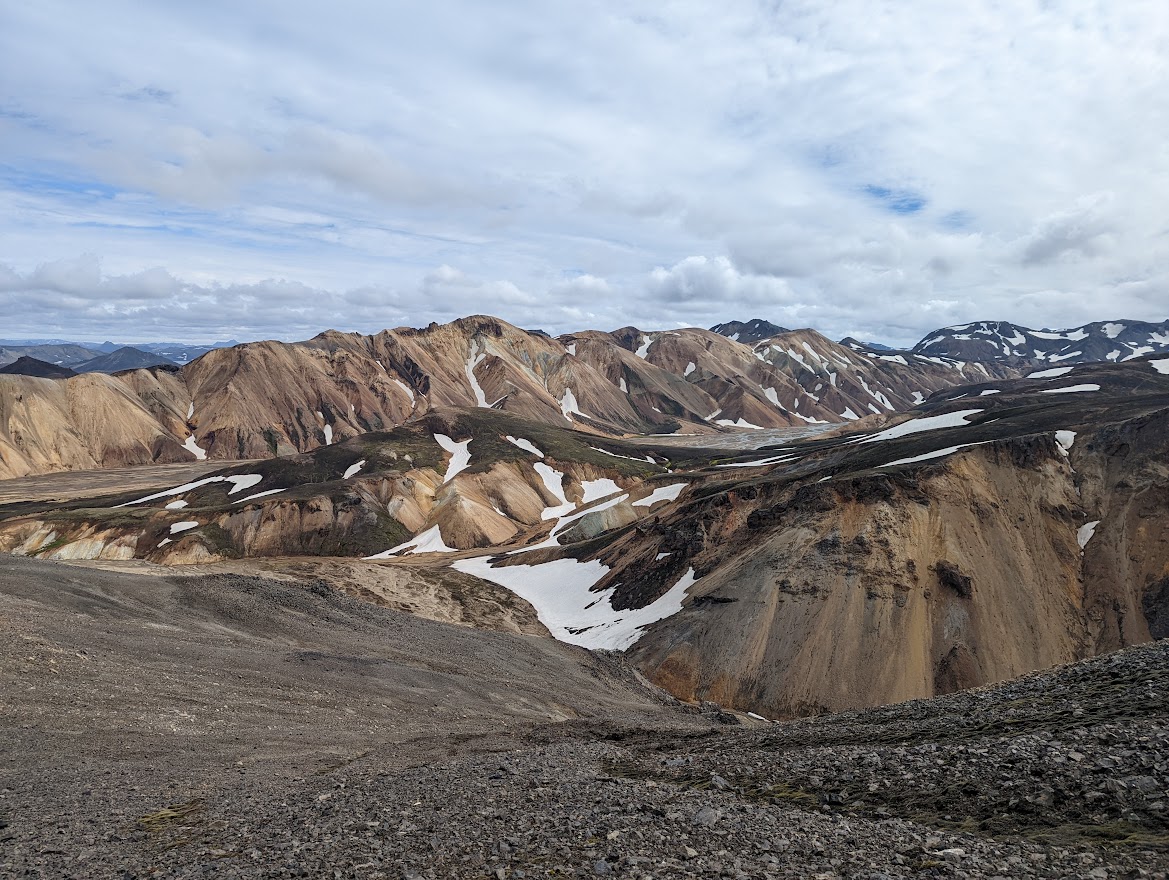
After getting the tent up I went for a short run that ended up being a bit long up the nearby hill of Blahnjúkur (Blue hill) and had a look at the first few kms of the race and the lava field it goes through. The rest of the day was spent marinating myself in the geothermal pool and nerding out about Iceland with German climate scientists and two American geologists part-way through a spectacular 3-week walk across the country.
It doesn’t get dark in Iceland in July, so there was no need for these silly early starts (I hate early starts, and mornings in general). The race itself started at a still-a-bit-early 9am, but getting the tent down, packing and lashing together my bags and getting food in me woke me up. Several bus loads of runners (550 of them) arrived from Reykjavik at 8.30. I had somehow wound up seeded in the first group so at 9am we were sent on our way. I clearly wasn’t awake enough though as 100m from the start there was a river that had to be crossed by a plank, and I missed the mad sprint to get across it before a queue formed. This was followed by a short but tight climb through a canyon – so danger of starting off to fast in this race.
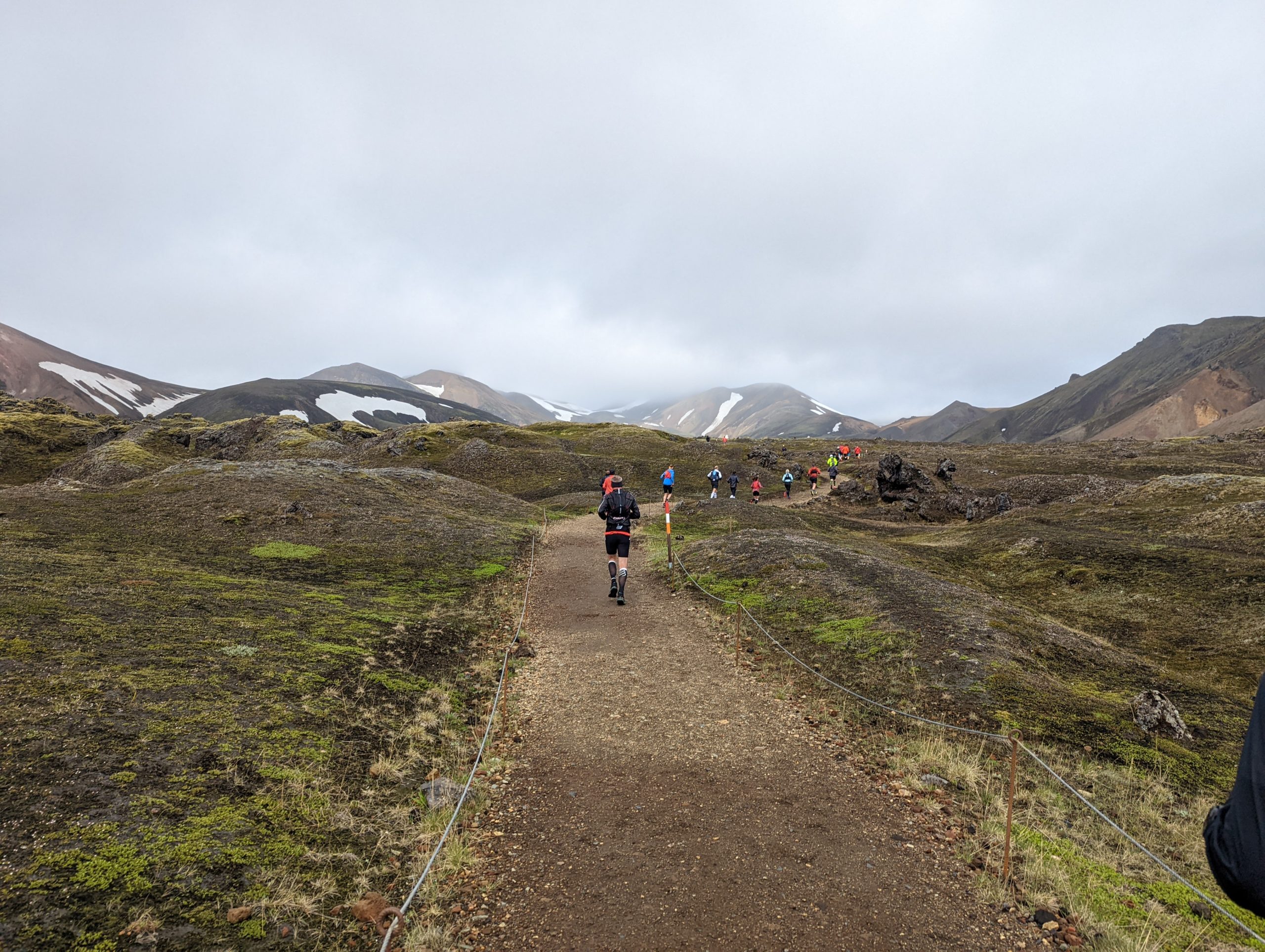
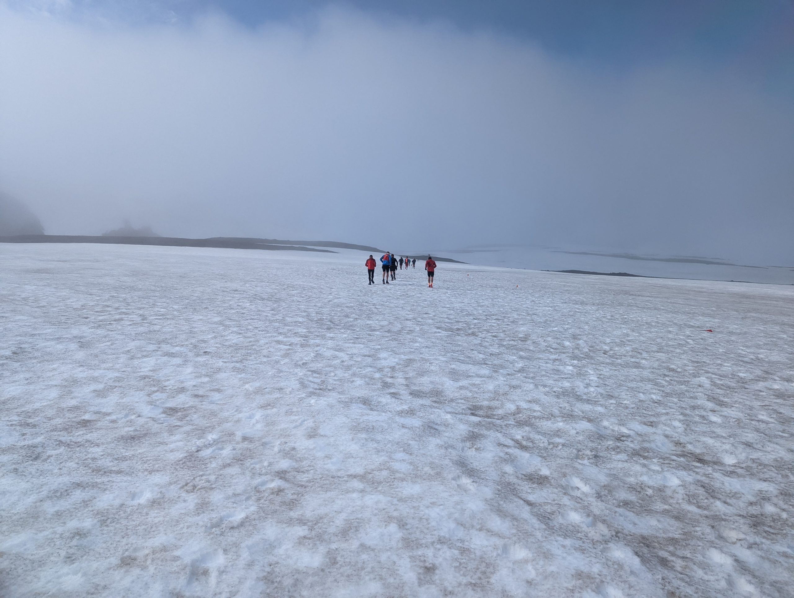
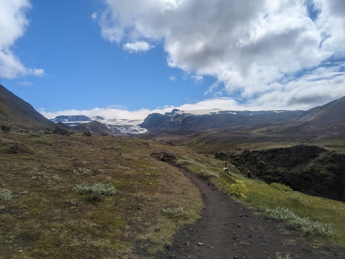
The course soon opened up, and the first 12 km were spent climbing to 1100m through steaming mudpots, rolling hills and long snowfields. The weather was a bit dreich for now and the fog was low but there were tantalising glimpses of hill and sky, and craic was had with the other runners – much easier to have a chat with someone when you’re pacing for 6 hours rather than 1.
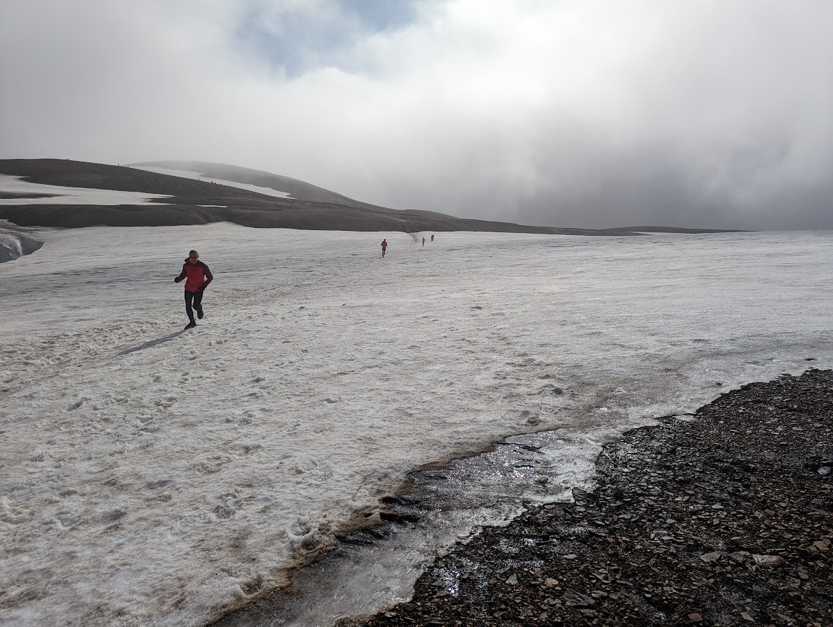
Icelandic placenames are fun. The first aid station was at the Hrafntinnusker hut after 13 km at the high point of the race, where I got to tick “drink Gatorade out of a watering can” off the bucket list. There followed an exciting and technical 500m drop where I got to use my downhill hallioning skills learned in the Mournes (perhaps unwise) and overtook a load of people – most of whom caught me as soon as things got flat again. Ah well. I fell in with a few runners and took a lot of photos, determined to enjoy myself and not blow up.
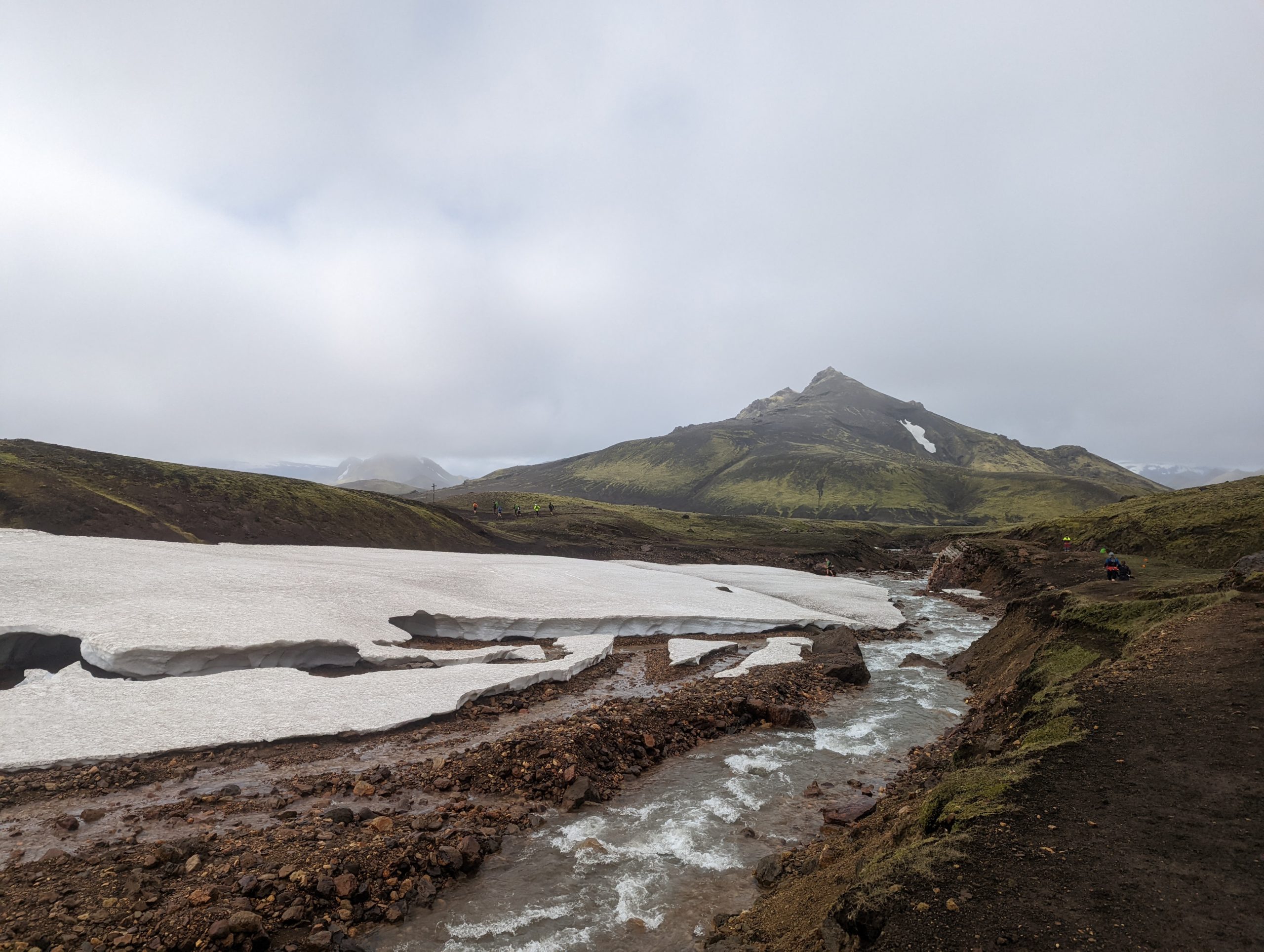

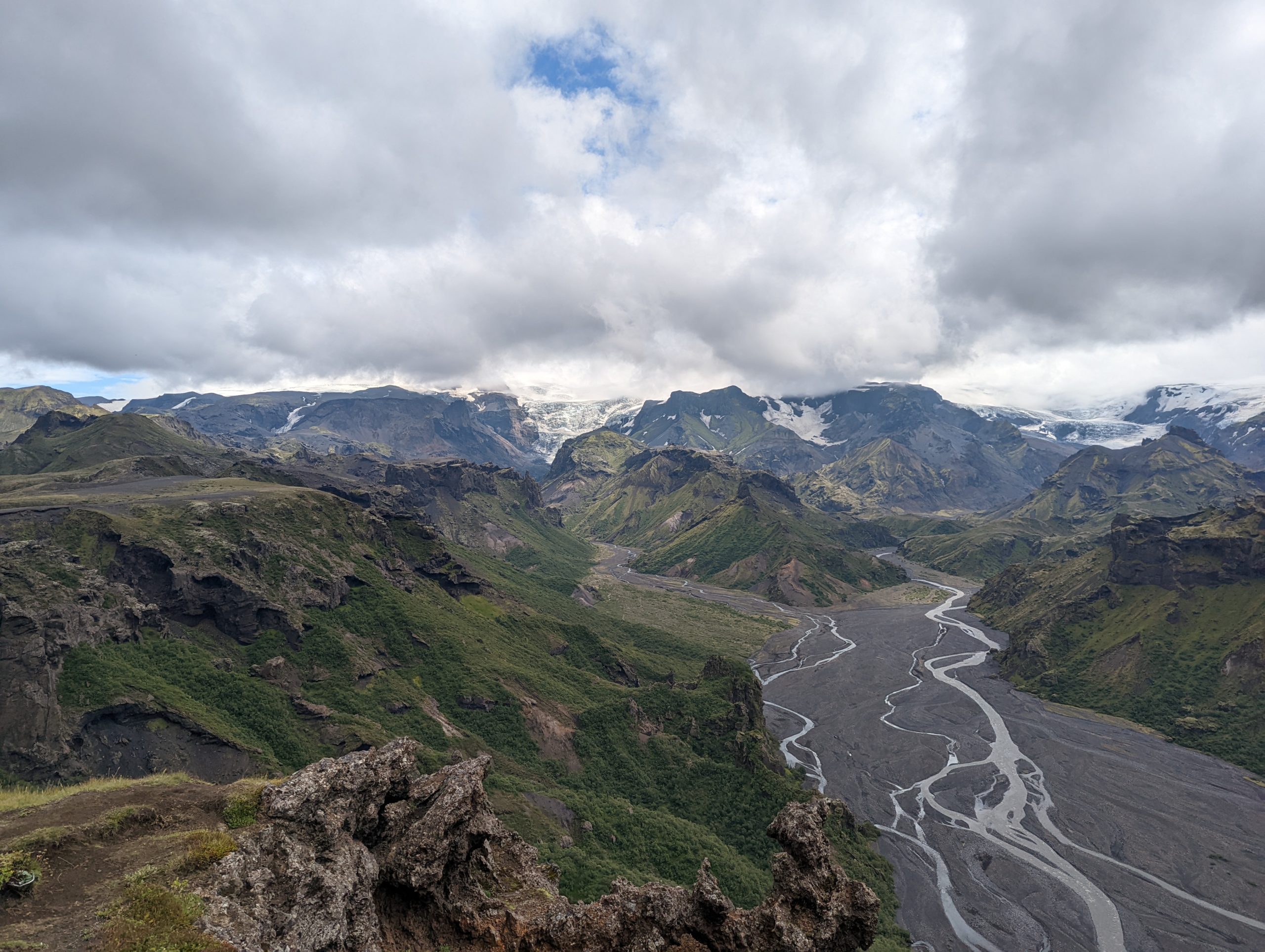
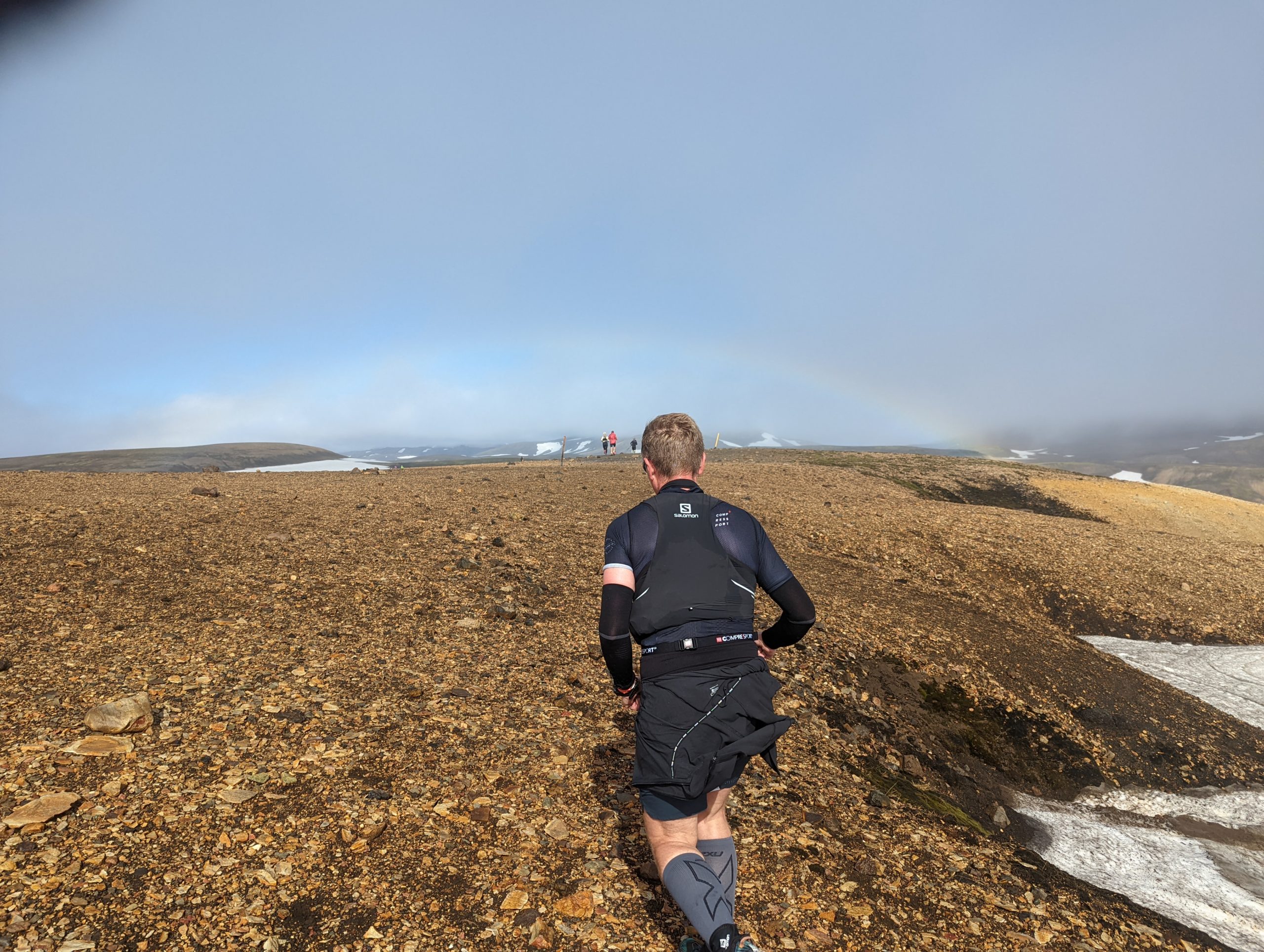
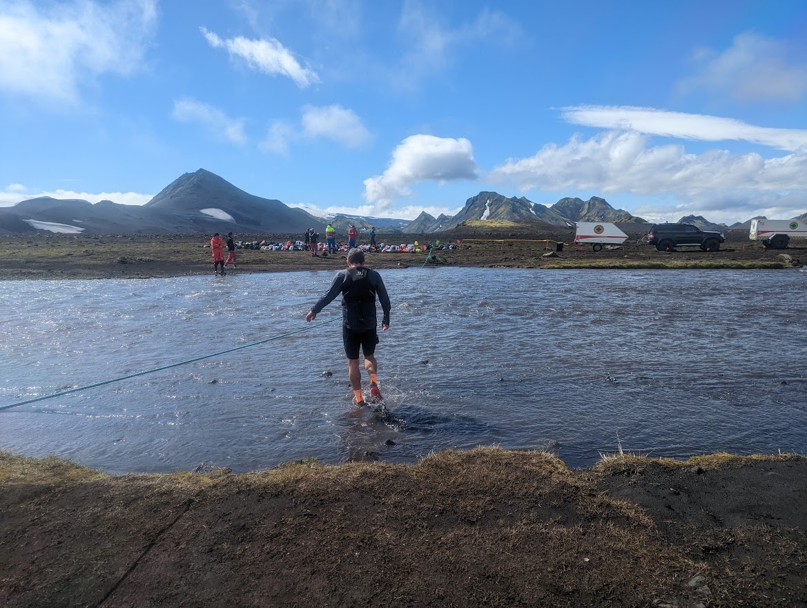
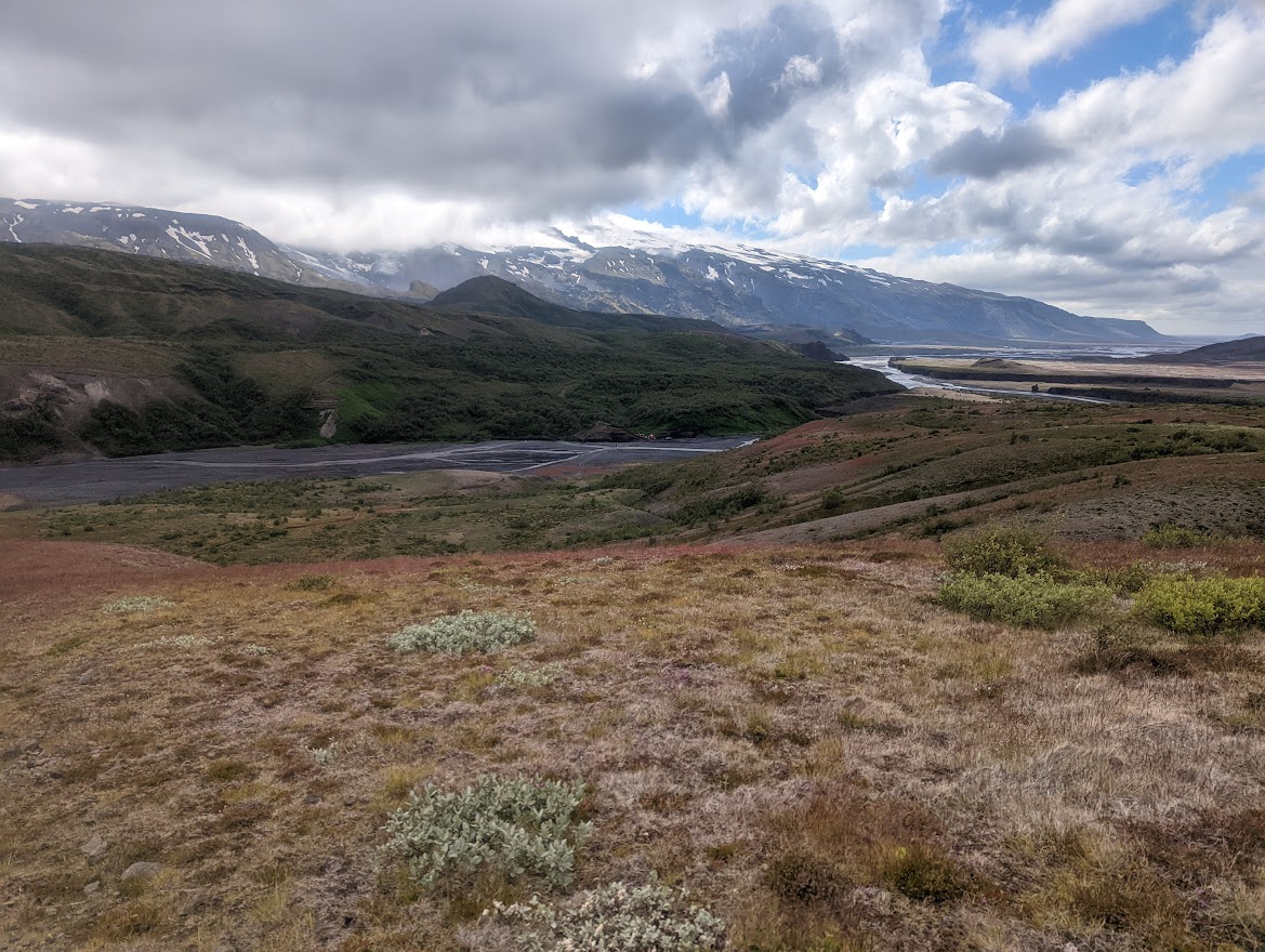
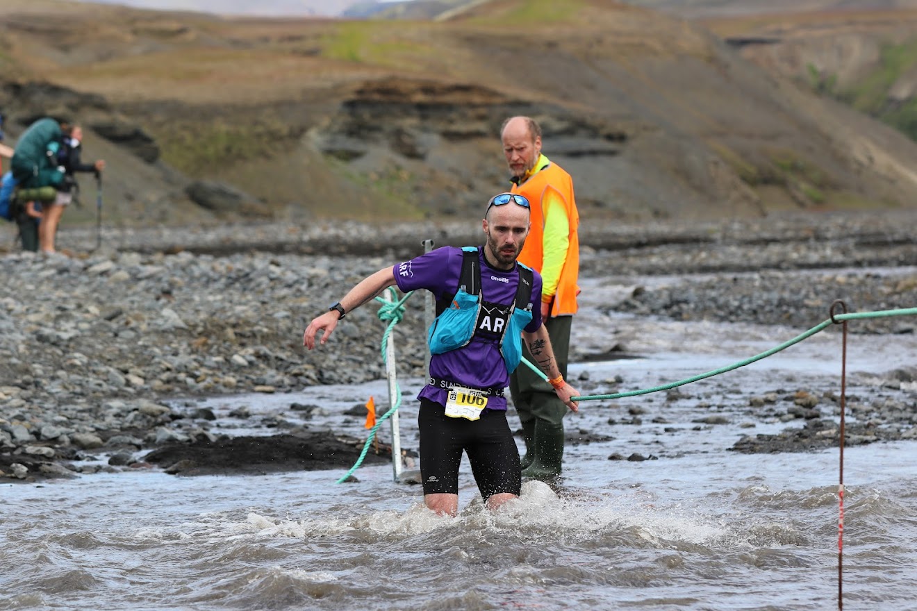
We passed lots of walkers (Americans are far too enthusiastic) and soon the soil gave way to volcanic sand, with great green mountains that all looked a bit like Errigal rising from the black desert like great sharks’ fins. Sections of cracked lava pavement interspersed with sand and the odd river crossing, some of which got rather exciting and were equipped with ropes, overseen by Search and Rescue teams. A vicious headwind rose after the 2nd aid stop at Álftavatn (Elf lake!) but died off by the half way mark at the Bláfjallakvísl (Blue mountain fork) river crossing, where blue skies reigned and the vista opened up to a vast, black moonscape. I’m not that used to long flat runs at a steady pace (I hate tarmac) and so the next 15km on sand was challenging but I hung on to the coattails of an Icelandic runner on his 6th go at the race, who acted as a bit of a tour guide.
My legs were tiring but I was (unusually for me) getting the nutrition right and at 4 hours and 40 km in I reached the Emstrur hut aid station and downed a whean of Pepsi and a rake of Cinnamon buns. The next 10 km was spent doing mental arithmetic comparing what was left with what I had already done, counting down the marker posts and trying to figure out if the race would actually be 55 km as advertised or actually a bit short. By this stage I was walking the uphills and suffering a bit on the down but was able to maintain quite a steady pace and despite the sand and river crossings was remarkably blister or pain-free.

With the view starting to resemble the photos I had seen of Þorsmörk, I came over a hill and spotted a big arch on the path ahead, just after a river. With 50 km done I was convinced this was the finish line and opened up down the hill to reach the river, only to discover that this was a Red Bull aid station upon reading a “2.8 km to go” sign. Damn capitalists.
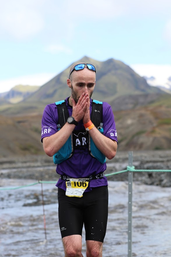
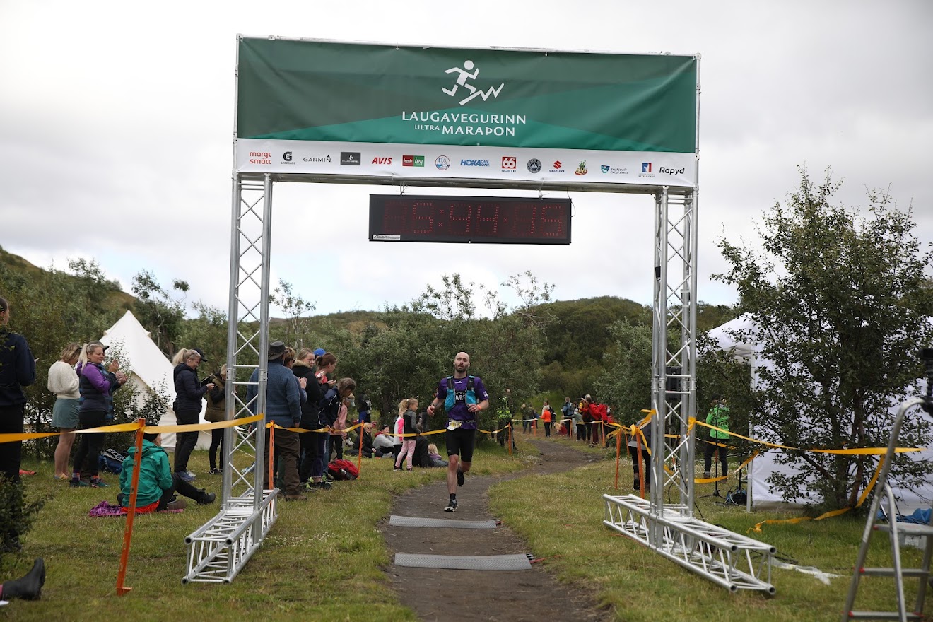
I downed a can, reset the mental countdown and pushed on. The last section was through trees, which confused my tired brain as the last 5.5 hours of desolate volcanic terrain had made me forget that such things exist. At the top of the last hill I spotted two runners ahead. The Red Bull marketing must have something in it because at this point I got it in my head to chase them and somehow caught them both in the final kilometre. I tumbled across the line in 5 hours 44 and 41st place. Icelandic efficiency took over at this point and I was handed a bowl of food, shepherded into a tent and guided to my bags, and pointed to the showers a shed with some hoses of warm water. Before long I felt vaguely human again and was sat with a cheeseburger and an expensive pint trying to make sense of what I had just experienced.
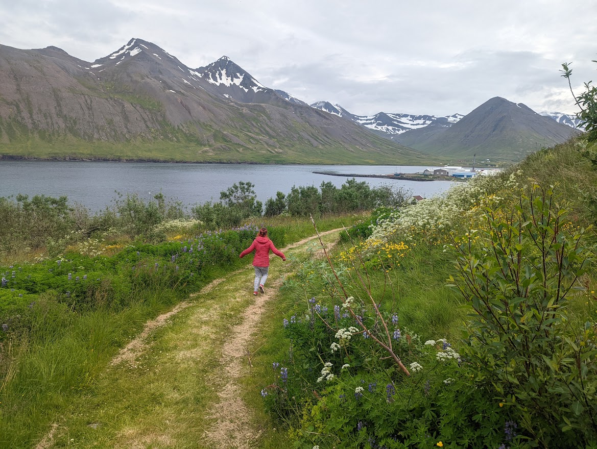
A few hours later I had the tent up and Lisa joined me. We spent the next few days recovering badly by hiking around glorious Þorsmörk before returning to Reykjavik, hiring a Dacia and heading to the North of Iceland for more ridiculous beautiful scenery and remarkably good weather.
I can’t recommend the Laugavegshlaup enough. Mixed terrain, plenty of hills, long (but not too long) and all in the most amazing setting. Definitely more than just a race – an express ticket to the awe-inspiring Icelandic interior and an unforgettable, humbling experience that I’m very fortunate to have had the opportunity to take part in. I’ll be back, I hope. Arf Arf.